New York City has some of the world’s worst traffic, wasting its residents’ time, slowing buses, and exposing people to pollution, especially in neighborhoods with many people of color. To relieve the traffic burden in Manhattan while creating new funds for public transportation, state lawmakers approved congestion pricing, which would charge drivers $15 to enter Downtown and Midtown. The system would be modeled on programs implemented in London, Singapore, and Stockholm.
But in June, New York Governor Kathy Hochul announced an indefinite program delay. While Metropolitan Transportation Authority board members still say they will begin implementation whenever they get the okay, it’s unclear when this will occur.
Congestion pricing would provide quality-of-life improvements for residents while increasing transportation efficiency, so getting it back on the agenda remains important. But pricing is not the only mechanism to reduce traffic and cut greenhouse gases.
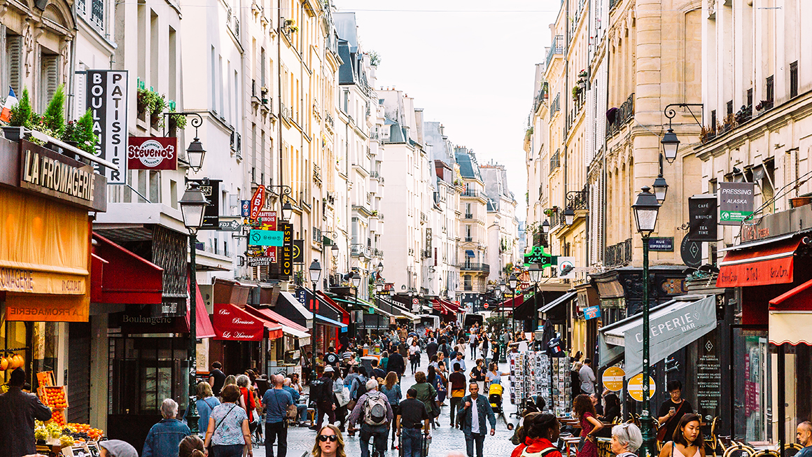
In Paris, France, decades of urban design choices and expanded investment in noncar transportation have produced a sustained drop in car use—as well as fewer crashes and less pollution. The Parisian approach could be a model for New York and other cities.
Discouraging automobile use by reducing car-centric street space
Key to Paris’s urban transportation policy has been the steady transformation of previously car-centric streets into pedestrian-focused environments, building on the 2021 decision to limit drivers to 30 km/h (~19 mph) on most streets.
Notably, in 2013 and 2016, Mayor Anne Hidalgo closed highways that once ran on the Seine River banks to cars. This change created new public spaces open to pedestrians and cyclists in the city center.
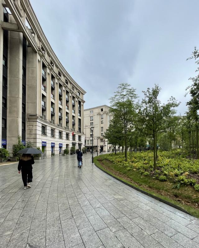
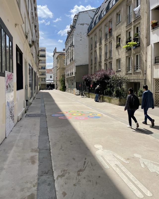
Such transitions occurred along many small streets too. In 2016, the city began establishing neighborhood car-free zones on weekends, giving people more freedom to safely move around their community. The city has since advanced these efforts more dramatically, reducing car space at several of its major intersections, such as the Bastille and République squares, and installing pedestrian plazas and vegetation. Expanded sidewalks and planting areas have become common. At one square on the city’s south side, a grey and concrete roundabout transformed into an “urban forest.”
The city also created “school streets”—pedestrianized and landscaped blocks in front of elementary schools that slowed traffic or eliminated car access entirely. Since the program began in 2000, 205 school streets have been implemented, with 95 more planned by 2026. Over the same period, the city will eliminate half of its street parking spaces, adding 161 acres of pedestrian space, and officials are planning a limited-traffic zone in central neighborhoods.
While New York City has already begun working toward many of these policies, the city still lags dramatically behind Paris’s progress—and other American metropolitan areas have ample room to pursue these strategies.


Investments in noncar modes of transportation provide alternatives
Simply reducing the automobile footprint in the public right-of-way could theoretically limit mobility unless alternative options are available. To that end, Paris and the regional government have invested in improvements for other transport modes over the past few decades.
The city has established more than 1,500 kilometers of new marked biking routes, including 350 kilometers of protected, dedicated cycleways and two-way cycling routes on otherwise one-way streets (by comparison, New York City is far behind in implementing its bikeway expansion program). These city investments have been supported by regional improvements that totaled 4,000 kilometers of bike paths by 2023, a 54 percent increase over 2019.
Simultaneously, the regional and national governments invested in large expansions of the public transportation network, funded mostly by a tax on commercial space and parking facilities. Since 2010, the region added 202 kilometers of bus rapid transit, tramway, and metro lines, and 272 more kilometers are under construction. By 2031, the already substantial metro network will be 88 percent longer than it was in 2010.
Most of these improvements have been undertaken in the suburbs, such as the new Metro Line 14 extension to the city’s south.
Paris’s choices and investments have successfully achieved policy goals
These transportation policies have transformed people’s travel patterns, both in the city and regionwide. Overall, Paris has experienced a marked decline (PDF) in car traffic, which fell by 50 percent on city streets between 2002 and 2022.
Parisians simply don’t drive as much as they did. The share of city households owning a car declined in 2020 to its lowest levels since at least 1975 (car ownership is also now declining in the suburbs), even as the share of households that owned a car increased substantially in France since 1995. The number of daily car trips taken by the average Paris resident is about half of what it was in the early 1990s.
In Paris, Car Use Is Increasingly Uncommon for Typical Households
Source: Atelier parisien d'urbanisme (2022) and Omnil (2022).
Notes: Near suburbs = “petite couronne,” which includes the three suburban counties ringing the city of Paris.
Instead, Parisians are more likely to walk, bike, or use transit. Between 2018 and 2022, the use of the city’s major cycling routes increased by 166 percent (PDF), with two of the city’s cycleways ranking as the world’s most popular, according to one count.
Regional transit ridership increased by 35 percent between 2000 and 2019, and the typical regional resident rode trains and buses 383 times in 2019, compared with 315 times in 2000. Although the pandemic reduced transit use, ridership is now almost back to 2019 levels.
These travel changes have had quality-of-life benefits. The number of people taken to hospitals for crashes involving cars declined by more than half between 2007 and 2022. And the city has experienced a net reduction in air pollution concentration over the same period.
US cities should consider following Paris’s example, but congestion pricing remains a good idea
Paris has demonstrated that it’s possible to significantly reduce car travel over the course of several decades through planning, investment, and design choices.
US cities considering how to generate similar changes should, first, identify target streets that they can transform into public spaces that prioritize pedestrians. Second, they should commit to investing in other modes of transportation, such as cycleways and transit lines. Paris’s example shows that investments in suburbs, especially, are key to creating regional alternatives to driving.
However, these changes aren’t a quick fix. Paris’s progress took decades and sustained political support from two mayors and dozens of city councilors, including in the face of public opposition. US cities routinely face pushback when they try to transform car spaces into environments for pedestrians.
The implementation of congestion pricing in cities like New York remains a good idea—and a complementary one to the improvements like those in Paris. Cities with congestion pricing have been able to execute dramatic changes quickly, and congestion pricing can provide a useful source of funding for public transportation improvements. Indeed, without congestion pricing, New York has already had to pause transit improvements, such as an expansion of the Second Avenue Subway.
While policymakers who want to advance the quality of life of their residents can use Paris as a model and inspiration, they should still consider a variety of solutions to transform transportation.
Let’s build a future where everyone, everywhere has the opportunity and power to thrive
Urban is more determined than ever to partner with changemakers to unlock opportunities that give people across the country a fair shot at reaching their fullest potential. Invest in Urban to power this type of work.